Route 17 red - Lac de Rabuons
Add to my favorites

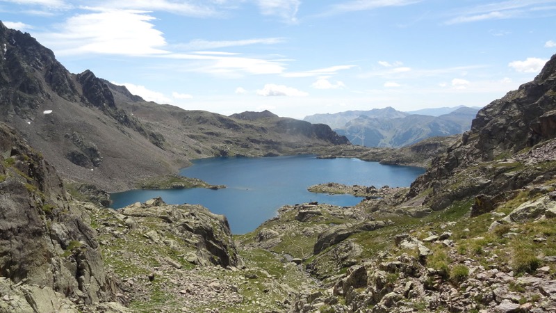
A big climb till the Energie track that will take you to the Rabions lake at 2500m, dominated by the Tenibre mountain (3031m). the lake is the biggest of the french Riviera, a real beauty, a return journey with a demanding and technical descent.
The characteristics of the route.

Saint-Étienne-de-Tinée (06)
- Distance 9 km
- Elevation gain 1440 m
- Elevation lost 70 m
- Min. elevation 1137 m
- Max. elevation. 2519 m
- Duration (depending on pace) 2h30 à 5h
Read before you go!
Trails in the Mercantour National Park. Dogs are not allowed.
- Follow the marked trails, do not take shortcuts.
- Before setting out on a trail, check the weather, make sure it is suitable for your level, and leave your route with someone.
- Be careful.
- Be extra careful during hunting season and find out about current drives.
- If you encounter livestock protection dogs, remain calm, avoid sudden movements, and go around the herd.
- Respect private property and cultivated areas, and close gates after you have passed.
- Behave in an eco-friendly way: take out your waste and respect the flora and fauna to preserve nature.
- Always download the route (GPX) corresponding to the route in question.
Area : St Etienne de Tinée
Report a problem
Pdf map
Add your time and share your feelings
Services nearby

The Sundials
Saint-Étienne-de-Tinée

Museum of Religious Art
Saint-Étienne-de-Tinée
Le Clocher
Saint-Étienne-de-Tinée

Bell Tower Kindergarten
Saint-Étienne-de-Tinée
Leisure center Les Eterlous
Saint-Étienne-de-Tinée



Follow us on
the digital trails
the digital trails




Info & contacts
Offices de Tourisme du territoire
Auron : +33(0)4 93 23 02 66
St Etienne de Tinée : +33(0)4 93 02 41 96
St Dalmas le Selvage : +33(0)4 93 02 46 40
 Auron Outdoor - Parcours - Route 17 red - Lac de Rabuons
Hello, world! This is a toast message.
Auron Outdoor - Parcours - Route 17 red - Lac de Rabuons
Hello, world! This is a toast message.
Auron Outdoor - Parcours - Route 17 red - Lac de Rabuons
Hello, world! This is a toast message.


OK
Annuler